|
StoryMap: Power and Promise Beneath the Salton Sea
November 2023 This in-depth educational piece dives into the exciting possibilities of sustainably extracting lithium from geothermal brines in Southern California |
|
StoryMap: Tracking Water and Weather in the Rockies
August 2023 This brief vignette follows a day in the fieldwork of Berkeley Lab scientists studying snow in the rockies |
|
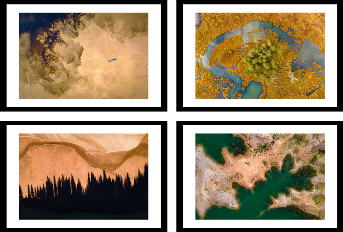
Gallery Installation: Landscapes in Flux
March 2023 This installation was a part of SKY, a show dedicated to climate change and environmental impact at The Drawingroom Gallery in San Francisco. The piece comprised 4 aerial overhead shots showing the phases and effects of sediment transportation by rivers, and the ways that humans have altered this essential process with dams.
|
|
StoryMap: Data Streams
November 2022 This collaboration between the K-12 Education team and the Earth and Environmental Sciences Area at Berkeley Lab explains how engineers and river scientists are collaborating on networked sensors to study mountain watersheds like never before. |
|
StoryMap: The Quest for Liquid Sunlight
August 2022 This educational project was produced to accompany a live event at the Bay Area Science Festival in 2022, and designed to teach high school students about Berkeley Lab's research on creating liquid carbon-based fuels out of sunlight. |
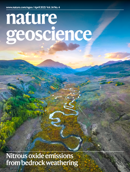
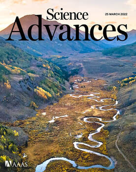
StoryMap: Rocky Mountain Water
(and covers of Nature and Science!)
|
|
At the Smithsonian
The Smithsonian Museum of Natural History has featured my writing and photography work on social media 24 times to date. Here are a few instagram posts showcasing how I used photos to highlight fascinating facts and specimens that I encountered during my time as an intern.
StoryMap: A Cultural Map of the Rio Marañon
January 2020
The Kukama people are an indigenous group in the Peruvian Amazon, whose culture and history is closely intertwined with the Marañon river on which they live. Their oral history of the river contains a rich store of cultural knowledge, as well as an important history of the trauma and violence inflicted when European rubber barons enslaved and exploited indigenous people to harvest latex. As part of my Watson project, I joined the Wildlife Conservation Society and local organizers from Radio Ucamara in collecting material for a cultural map to record the locations of historic events and cultural myths along the Marañon. From these maps and the photos, we created a ArcGIS story map to present and share these stories.